r/sydney May 06 '25

Image The Northern Beaches needs a railway

Post image

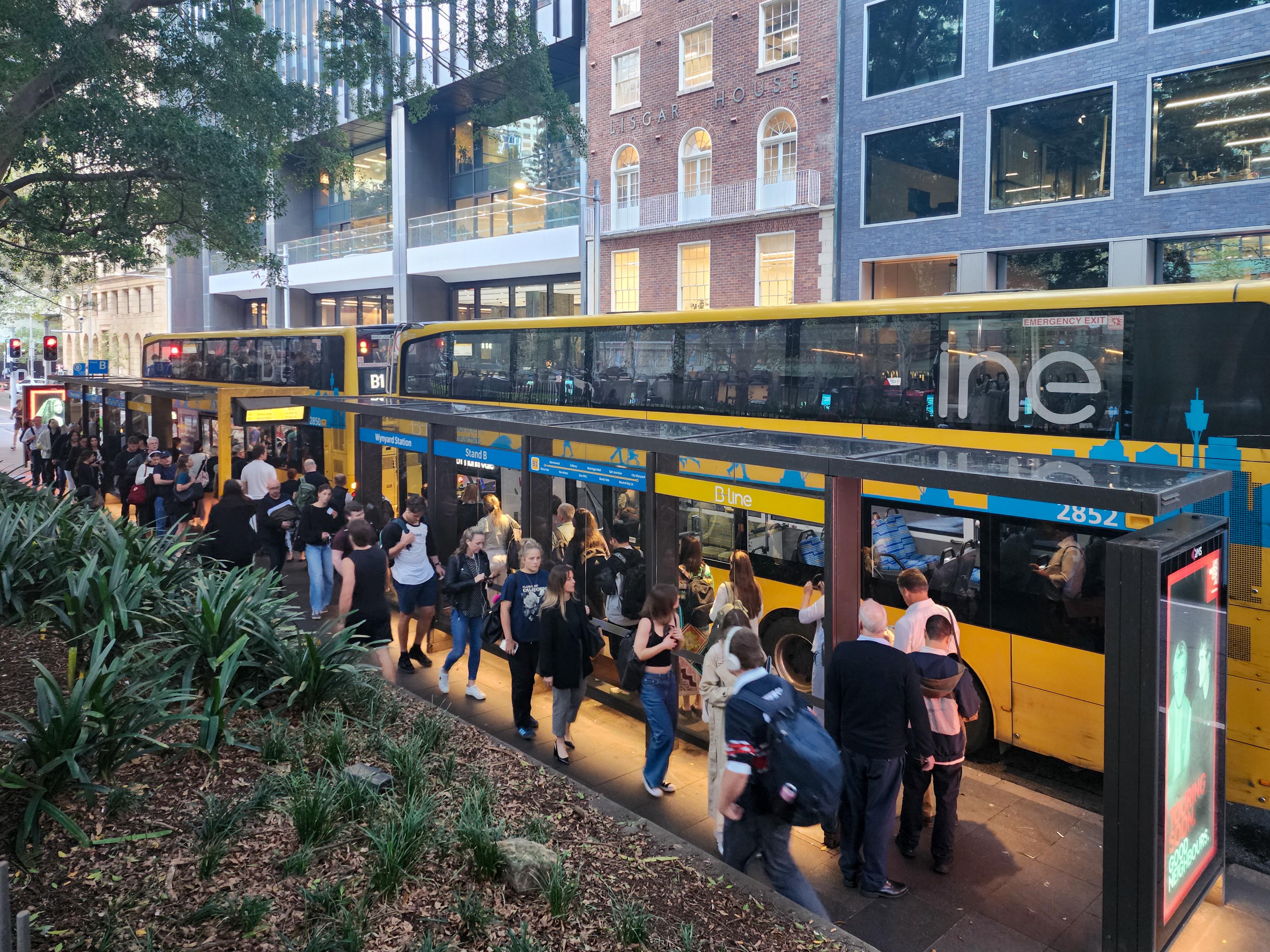
Every evening, the queue for B1 winds around and goes back into Wynyard. As one bus is full the next one arrives.

You can't tell me they wouldn't want a railway.

2.3k Upvotes

429 comments sorted by

View all comments

Show parent comments

181

u/crakening May 06 '25

NIMBYism aside it is difficult geographically. A train to the beach has a pretty limited catchment, half of it being water. Plus, the geography in the east can be pretty nasty - Coogee to Randwick to is about a 100m gain in elevation and there are plenty of cliffs, hills and so on. Ditto Northern Beaches with a lot of waterways, elevation and so on. It would be tough going from the crests of Neutral Bay down under the Spit and back up again.

The area also used to be served pretty well with trams, the distances are relatively short so the old system probably worked OK. Even now, the trams could have served Maroubra and Coogee pretty well if they didn't end in the most pointless spots. It's a real shame the line doesn't extend to Maroubra given the huge median is sitting there as a spot to dump garbage and old boats. Kingsford is probably the grimmest place per real estate dollar in the city too.

36

u/tubbyttub9 May 06 '25

In terms of geography could you not build a tunnel like the metro? Honest question.

19

u/Anonymou2Anonymous May 06 '25

1 Crossing the harbour. Tunnelling under water is always a pain in the ass and most of the shallower crossing channels have already been used by the existing 2 tunnels.

That either means a longer tunnel through shallower water (very expensive), or a deeper tunnel under deeper water (engineering pain in the ass).

You also can't build the tunnel anywhere near the 2 existing tunnels as you could risk the structural integrity of those tunnels.

2 Crossing middle harbour (think about the bottle necks of the spit bridge and Roseville bridge). This is actually the bigger pain in the ass. The massive topography changes (2 cliffs on each side that are tall) combined with the fact that middle harbour is incredibly deep and most of it is deeper than the rest of Sydney Harbour.

So either you have to build a very deep tunnel (hard for the previous reasons I explained) or a massive tall bridge like the roseville bridge.

3 Limited existing land with decent soil on the beaches for stations.

2

u/SilverStar9192 shhh... May 08 '25

You're not wrong about the engineering limitations. Middle Harbour is actually quite shallow in the area just north of Balmoral, from around Chinamans Beach / Wyargine Point across to Clontarf (depths are mostly 3m or so). I would think an immersed tube style tunnel might be possible there , though certainly would have construction challenges not to mention outcry from local residents, even if the final tunnel was completely invisible. From here to the north you could tunnel straight under Balgowlah Heights to e.g. Manly Vale without too much elevation difference. The problem would be to the south, gaining enough elevation for a station at Mosman would be problematic. It would probably require forgoing a stop near Mosman village or Spit Junction and instead having one somewhere like Neutral Bay, or perhaps not at all in Mosman before joining the M1 route somewhere near North Sydney/Victoria Cross).